This week, a friend and I completed a circumnavigation around Sunset Beach, Ocean Isle, and Oak island. As is often the case with these sorts of trips, we ended up having to do some on the fly planning, as mother nature decided to throw a monkey wrench into our well laid plans.
Throughout our trip, we would consult multiple sources of information, spend a great deal of time discussing and weighing our options, and making some rather significant changes to our plans in order to make the trip work.
The Plan
Our original plan was for a leisurely one island per day trip, staying at an AirBNB in Ocean Isle while we paddled around Sunset Beach and Ocean Isle, before moving to a different AirBnB near Southport for our Oak Island circumnavigation. The first two islands were both short paddles, about 16 and 13 miles respectively, with the last, Oak Island, being closer to 28 miles.
Some Complications
We had planned this trip a month or two out, but as we got about a week out, weather was starting to look a little rough. There was an arctic cold front moving in, which would end up breaking over 400 cold weather records across the country.
For us, it wasn’t so much the cold, however, but rather the effect this cold front was going to have on the sea state that concerned us. On the second day of our planned paddle, the swell was predicted to jump from 2 feet in the morning to over 6 foot by the afternoon, with winds increasing over night to 16 KTS, with gusts over 25 KTS. Not to mention, a drop in air temperature of 15 degrees during the afternoon and a good chance of rain.
Ultimately, this would force us to come up with a new, much more aggressive itinerary, as we pushed to still circumnavigate all three islands, while avoiding being on the ocean in what were likely to be less than ideal conditions.
Day 1
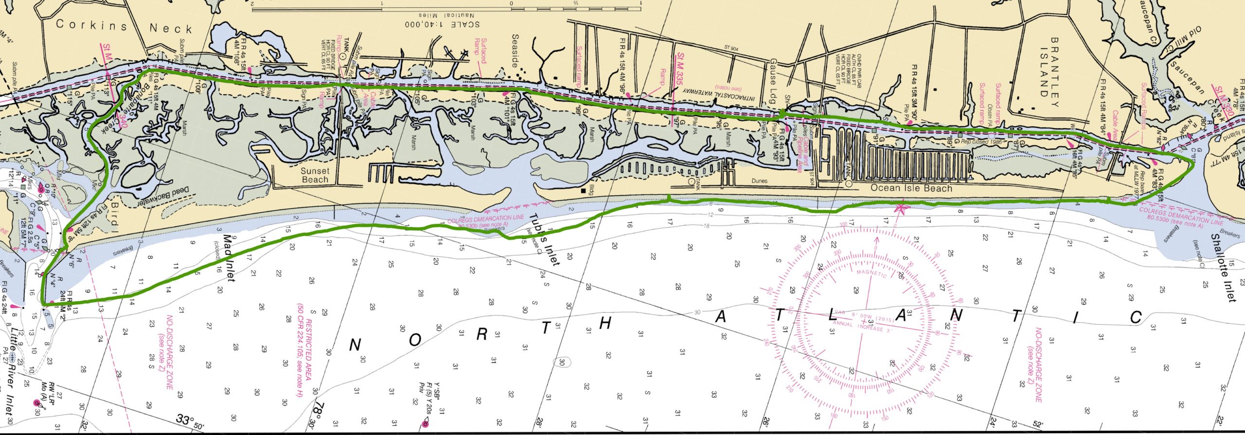
We were scheduled to do Sunset Island the first day, which would be about 16 miles, paddling down the Intracoastal Waterway(ICW) about 6 miles, before cutting through Bonaparte Creek to the Little River Inlet, then paddle 4 miles ocean side and return through Tubbs Inlet.
High water was at about 7 AM, and there would be some delay given our distance from the inlet, so there was no reason to get an early start. If we left too early, we would end up fighting a lot of current and then get to Tubs Inlet while the water was still flowing out.
We had discussed a 10 AM start time to give tide a chance to change. However, given the upcoming weather event, we decided that we would paddle to Tubbs Inlet and then depending on the time, conditions, and our fatigue level, make a decision on whether to paddle down to Shallotte Inlet, knocking out two islands at once.
Since we weren’t sure how Tuesday would work weather wise and since the following day was only going to be 13 miles if we broke it up into two days, this seemed like the most efficient use of time.
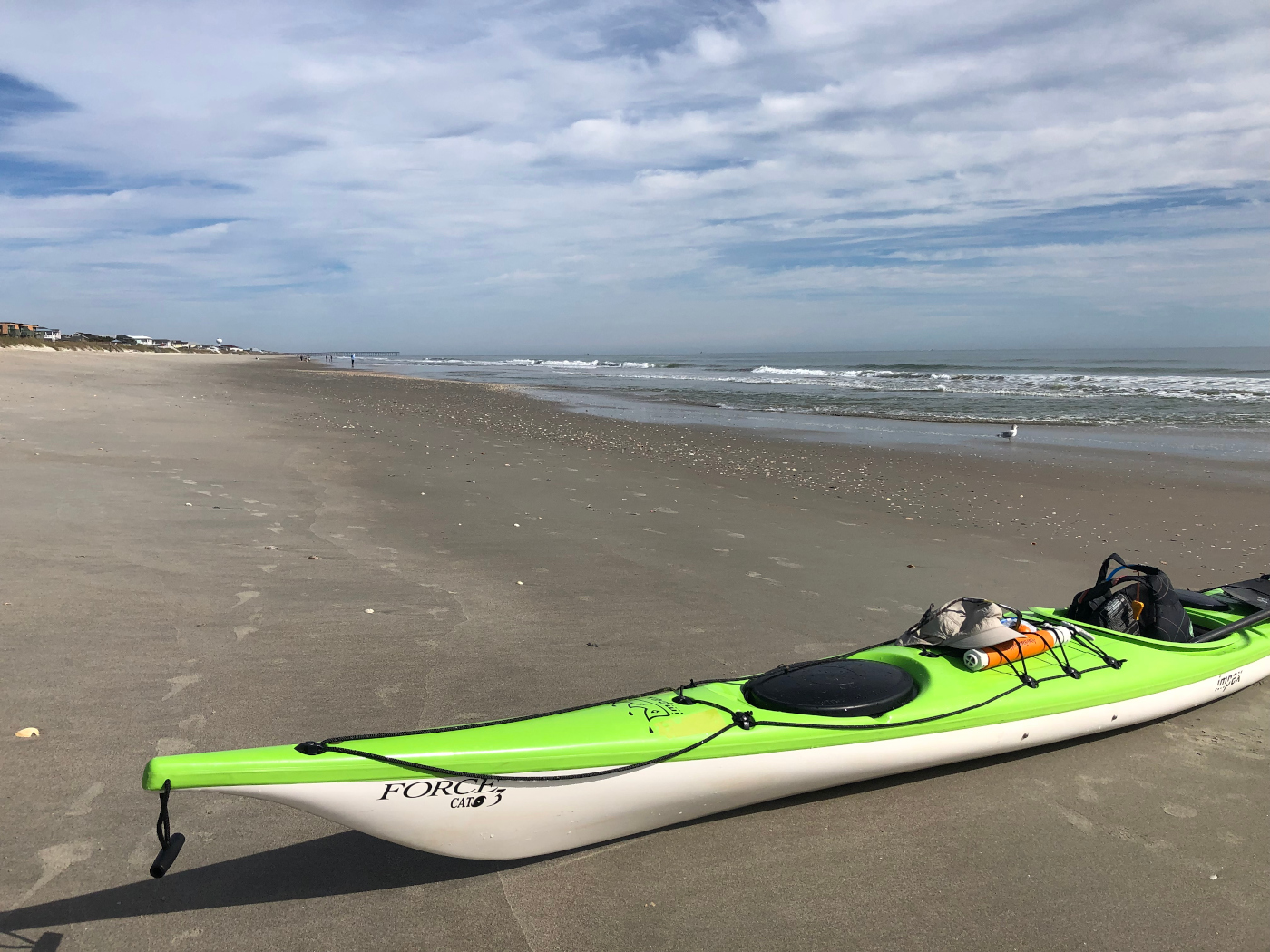
In an effort to give us as much time as possible, we decided to get on the water a little early and just deal with the current. We set out at about 8:50 AM and headed south towards the Little River Inlet.
It was obvious from the amount of energy we were expending that we were fighting some current, but a very distinguished downstream ‘V’ on an exposed piling, made it clear how much the current was working against us.
Despite this, we made good time and after paddling about 4 miles, the tide switched and we started to get a little help. By the time we reached Bonaparte Creek, which is very narrow and twisty, we were flying, averaging about 5.6 MPH. We briefly stopped to look at the conditions, which were quite flat, and then passed uneventfully out New River Inlet.
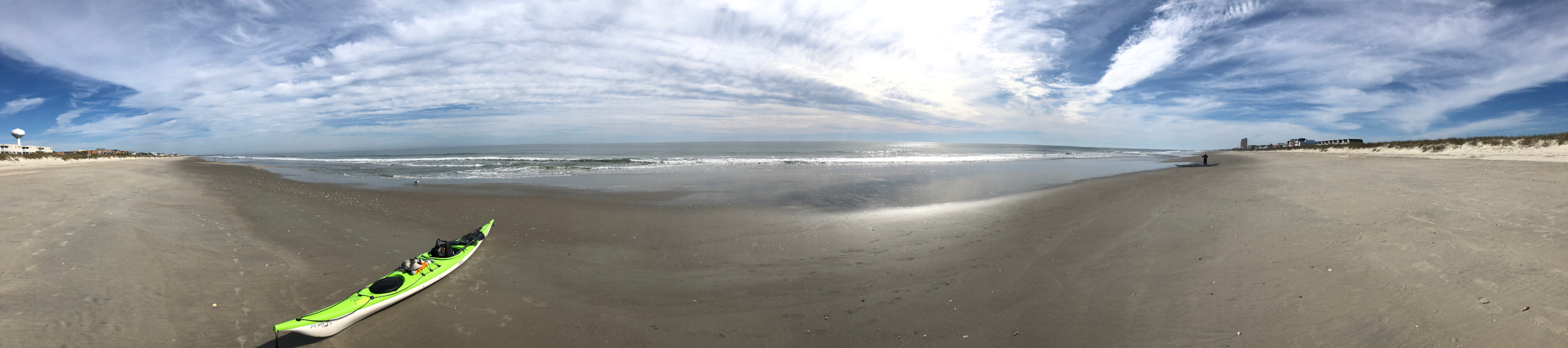
We reached Tubbs Inlet at about 12PM after paddling about an hour. The tide was not scheduled to change until 1PM and the conditions were still very flat, so we didn’t even stop and instead headed down towards Shallotte Inlet.
We made one beach landing along the way, before making a second landing right at the end of Shallotte Inlet.
One interesting thing about this part of the paddle was seeing how much erosion was occurring at the end of Shallotte Inlet. There were huge sandbags piled up in rows in front of and besides a number of homes, in an effort to keep the sea at bay.
After talking with a few home owners, we found out that much of this erosion happened after the local government dredged the inlet and moved the sand further down Ocean Isle to preform beach renourishment.
Despite feeling pretty good and seeing some neat looking breaking surf in the inlet, we decided to push on home and rode a nice current through the inlet, back to our AirBNB.
Day 1 Stats:
- Total Distance: 23 Miles
- Overall Average: 3.39 MPH
- Moving Average: 3.98 MPH
- Max Speed: 9.88 MPH
- Duration: 6.76 Hours
Day 2
The weather was predicted to be relatively calm during the morning on our second day, but building during the afternoon and evening.
The night before, we spent a great deal of time checking various data sources, like Windy, Noaa, Wind Finder, and Magic Seaweed, to try to help us make a decision on what to do for our second day, with some of the data being conflicting.
For instance, Windy had the swell state building rapidly to over 6′ by 1 PM. NOAA also showed a buildup, with a gale warning in effect. However, Magic Seaweed was reading flat during most of our research, although would eventually show a small buildup in the afternoon.
From looking at the weather, it seemed like if we were going to do any paddling, getting the oceanside out of the way first and as quickly as possible would be our best bet. By the time we went to bed, we had decided that we would just go out and play in the Tubbs Inlet area for a bit, then sit out a day and wait for things to calm down.
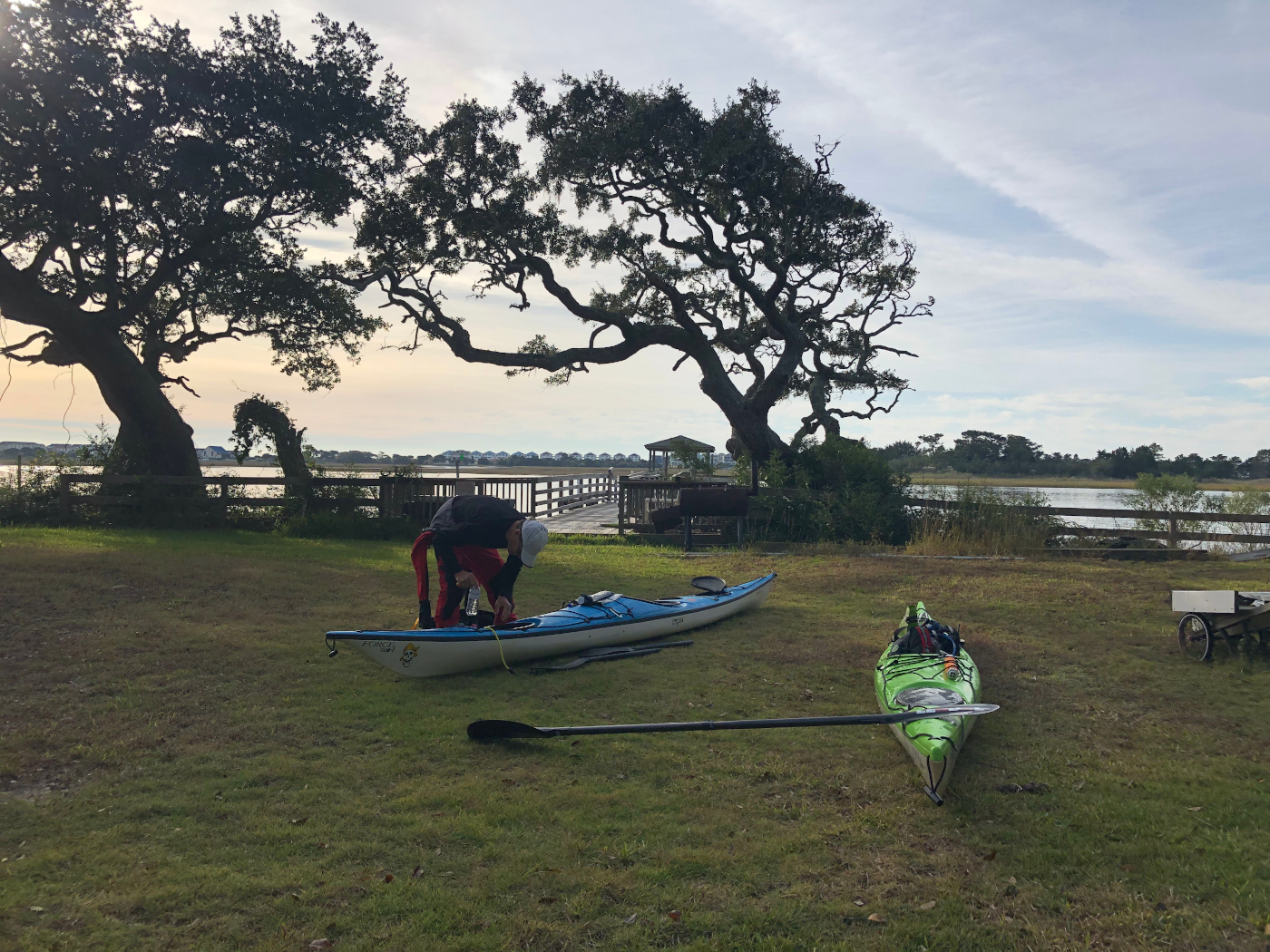
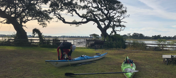
I woke up at around 5 AM, as my paddling partner was starting to get some coffee ready and he let me know that after sleeping on it, he thought we should leave and try to complete our Oak Island Circumnavigation today.
I didn’t need any convincing, as, like him, I had woken up during the night to check conditions and realized this was our best bet to successfully complete the trip. Conditions would likely be relatively calm during the morning and so we should have enough time to get off the ocean and back into the ICW before conditions became unmanageable. However, if we waited another day, we could have easily ended up having to sit out two or more days, as there was no guarantee the conditions would improve quickly.
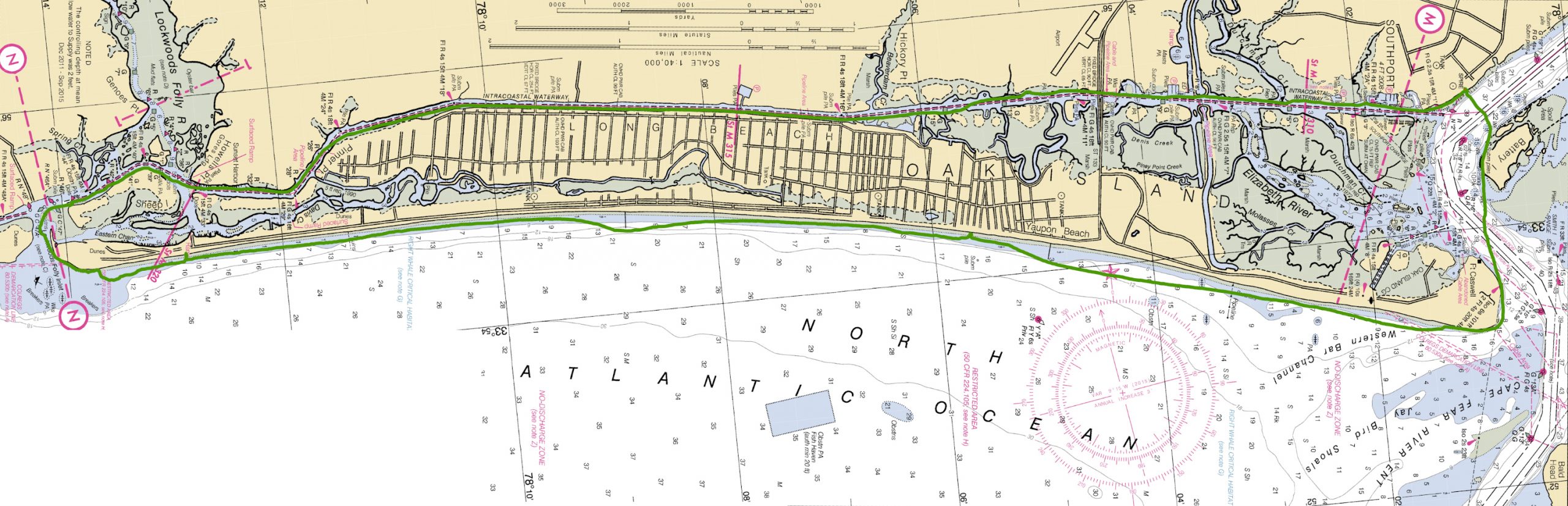
Our second AirBNB had a marina, so our original plan had been to launch from there. This was on the ICW though and about midway between inlets, so if we left from the marina, we were looking at 7+ miles just to get ocean side, then 13 miles of ocean paddling. Given the building conditions, we wanted to get off the ocean as quickly as possible, so opted for one of the options we had discussed the night before, which put us launching from South Port. This would mean we would only need to paddle about 2 miles before reaching the ocean and would give us our best chance of being able to beat the building conditions.
We arrived at South Port at around 7AM and were on the water by 7:30, launching from a small beach across from Battery Island and heading out the Cape Fear Inlet.
There is a shipping channel here, where large container ships make a dog leg turn around Battery Island and then head up the Cape Fear river to head into the port in Wilmington. As we were launching we saw two large ships, a coast guard cutter and a cargo shipping, starting to make this turn.
One of the first rules of dealing with large ships is that you should never try to outrun them, as their large size, makes their speed difficult to judge and they are going much faster than you might expect. However, knowing they would have to make the dog leg turn and with time being of the essence, we decided to cut in front of them.
This .71 miles would be one of the fastest of the day, with an average speed of 4.78 MPH and a max speed of 6.93 MPH, as we scrambled to get in front of them.
After paddling about 2.3 miles, we were on our way out the Cape Fear Inlet and decided to push on without stopping, as we could tell things looked clear. As we set out for the 13 mile ocean side paddle, we kept a cautious eye on the incoming swell.
While relatively calm, we soon became aware of some rather unsettlingly swell rolling in. Periodically, somewhat larger sets of waves with a very short period would roll through, then be followed by a period of relative calm. These rollers would gradually get larger throughout the day, with several rouge 5 foot+ swells coming through.
After 7 miles, we made our first beach landing and then after only a couple minutes got back on the water. One of the main disadvantages of re-arranging the trip in this manner, is that it completely messed up our careful tide planning and we would have to go out the Cape Fear Inlet and then back in Lockwoods Folly Inlet fighting current. With some prompting from me, we decided to fight the urge to paddle slow in an effort to let the tide go down and instead pushed on to towards Lockwoods Folly. We made a beach landing about 1 mile before the inlet, then headed through, carefully picking a path to avoid most of the breaking surf.
As we planned our approach to the inlet, we struggled with identifying where the inlet actually started. There is usually a place close to shore where there is a bit of a calm spot in between breaks, and Lockwoods Folly was no exception, but we didn’t want to go in too early and then be stuck riding along the shore with waves breaking over our beam.
Ultimately, after a brief discussion, we identified what we thought was the end of the inlet and a nice calm area, so decided to go for it. Other than a nice side surf, we both made it through without too much difficulty.
As we passed through the inlet the effect of the current became apparent and our speed dropped. It was about 12:30, so we decided to stop for about 30 minutes, to give the tide a bit of time to peter out, before hopping back on the water.
Before making it back into the ICW, we had noticed the wind increase and temperature drop, but as we cleared the island felt another noticeable pickup in wind, as well as some rather ominous black looking clouds. Fortunately, the weather would hold for most of the rest of the trip, the wind was sort of at our back, and we started to make good time again as the tide eventually reversed.
With about 5.5 miles left to go, the weather finally started deteriorating.
Wind picked up significantly, the temperature dropped quickly, and it began to rain. For the first time, I felt the need to pull out the Neoprene hood that was wedged into my PFD and dropped my skeg halfway to help reduce the amount of energy I was using to fight the wind.
We ended up paddling close to the shore in an effort to reduce some of the effects of the winds, which proved to be somewhat effective, especially when there were trees or structures in the way, even if they were a good distance away. One way you could visually tell this was by watching the grass blow in the wind. When in front of areas with a lot of trees or a building, the grass moves much less than areas only a few feet down, without anything blocking the wind.
We were off the water by about 4:30, but with the rain, cold, and cloud cover, it felt like it was closer to 6. As we stopped and the wind cooled our sweaty dry suits, we both began to feel the cold. By the time I was done strapping the boat down, my fingers had lost much of their dexterity. After changing in the overhang of a local building, we hopped in the car and headed to our AirBnB.
Day 2 Stats:
- Total Distance: 29.45 Miles
- Overall Average: 3.29 MPH
- Moving Average: 3.79 MPH
- Max Speed: 11.4 MPH
- Duration: 8.95 Hours
Closing Thoughts
One of recurring trend of these sorts of trips is that often despite the enormous amount of time and planning that goes into the trip initially, by necessity, you end up having to rework it on the fly later on, as the conditions ultimately dictate the itinerary, and this was no exception.
My paddling partner put a great deal of effort into finding places to stay that were on the water, worked with the tides, and had good launches, only for us to have to completely change up our plans for day 2.
Another interesting part of this is the amount of discussion and thought that went into these plans, as we discussed multiple different options and tried to weave together over 6 different sources of data(Windy, NOAA, Magic Seaweed, etc), which were somewhat conflicting, in order to come up with a plan that was safe and allowed us to meet our goals.