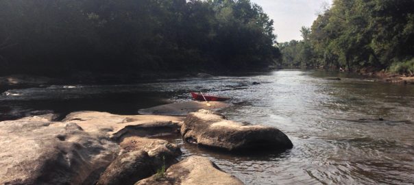
In part due to its proximity, I tend to spend a lot of time kayaking the Neuse near Raleigh. For the most part, it isn’t a particularly exciting river, with only a few places that have rapids, but it can be very beautiful and I often enjoy moving on a river more than flatwater. When the river really gets flowing, I often think of it as fast moving flat water.
The below table describes several runs you can do, along with the mileage and takeout points. While I’ve been as far as Goldsboro on the Neuse and you can actually take it to the coast, the below only covers the Wake County to Johnston Country runs(Milburnie Dam -> Smithfield.) There are about 14 Miles above this as well, from Falls Dam to Milburnie Dam.
Click on the location name to view more details about the takeout point, including the address and ease of access.
Update 2023:
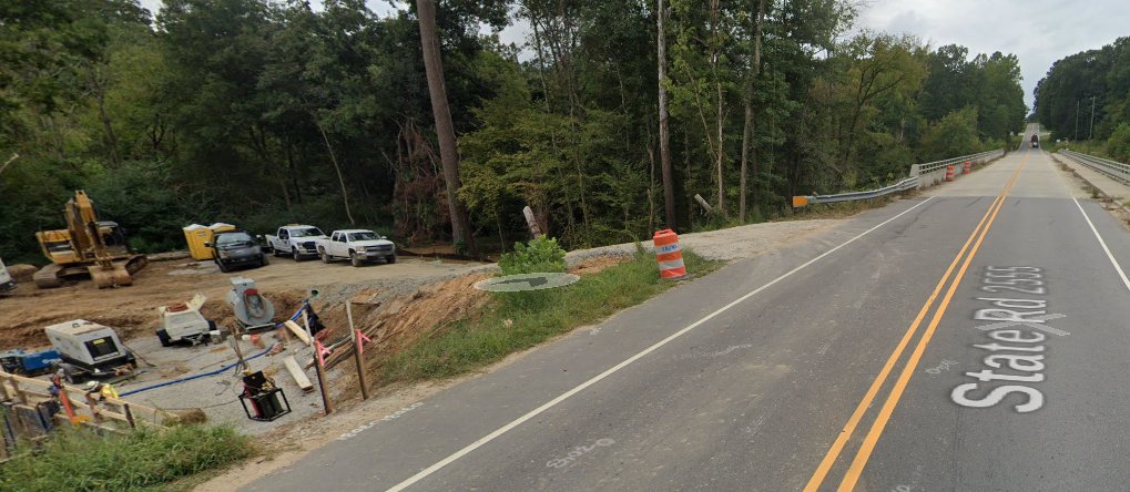
Recent construction along the Neuse has changed several of these launches. Poole Road, Milburnie Dam, Anderson Point, and Smithfield remain the easiest in terms of launching.
- Auburn Knightdale is the most notable change in terms of difficulty. Construction here has removed easy access to the side opposite the trail parking lot and this area is now much more overgrown.
- Poole Road launch has been improved.
- As of October 2023, Anderson Point access is limited due to construction, so you may need to carry your boat further to access this launch.
- With the removal of the Milburnie Dam, several of the bridges have become inundated with trees(strainers) and sediment has impacted the river making it difficult to navigate in low water conditions.
- Access to Highway 42 has been limited
Approximate Distance in Miles
| Location | Anderson Point | Poole Rd | Auburn Knightdale Rd | Mial Plantation Rd | Covered Bridge Rd | Hwy 42 Clayton | Market Street Smithfield |
|---|---|---|---|---|---|---|---|
| Milburnie Dam | 2 | 3.5 | 6.3 | 10.3 | 14.7 | 17.6 | 31.7 |
| Anderson Point | 1.5 | 4.3 | 8.3 | 12.7 | 15.6 | 29.7 | |
| Poole Road | 2.8 | 6.8 | 11.2 | 14.1 | 28.2 | ||
| Auburn Knightdale Road | 4 | 8.4 | 11.3 | 25.4 | |||
| Mial Plantation Road | 4.25 | 7.15 | 21.25 | ||||
| Covered Bridge Road | 2.9 | 17 | |||||
| Highway 42, Clayton | 14.1 | ||||||
| Market Street, Smithfield |
* Other Locations: There are a few other locations you can take out/put in, but the below are the ones I’ve found to be easiest and (IMHO) make for the best runs. See the other locations section below for some other spots you can put in at.
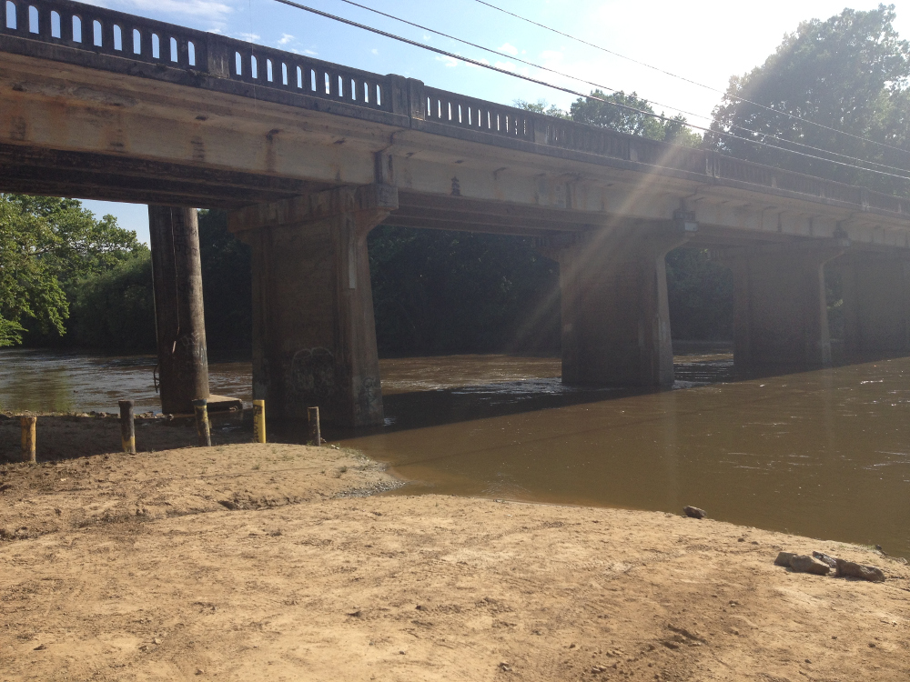
Milburnie Dam takeout
Parking/takeout Notes:
Parking is in a gravel parking lot, with several spaces and spots to park on the side. This is a popular place for fishing, as well as access to the Neuse River Trail, so can fill up.
There are several easy places to launch a kayak or canoe near the pedestrian bridge.
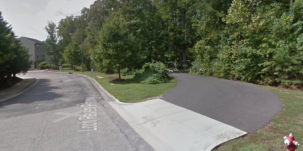
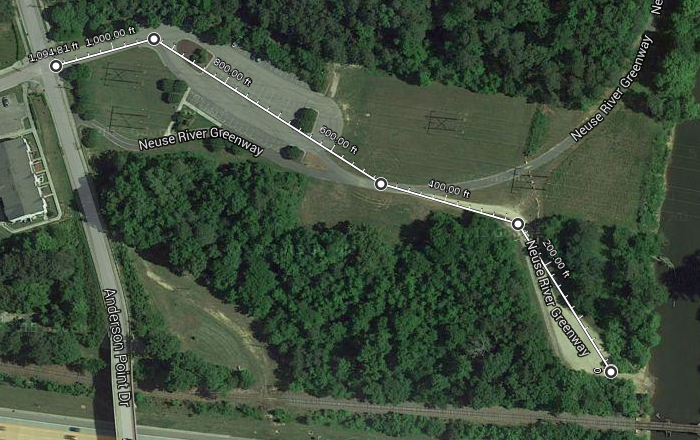
Anderson Point Raleigh
Update: As of October 2023, construction access has made access more limited, although still possible, the carry may be much further.
Parking/takeout Notes:
Enter parking lot and goto the end. Follow small road to the right and you can drive right up to entrance point. There is a large gravel lot, with plenty of room for trailers and turnaround. Since it is secluded and people like to hang out here, it may be better to move your car back to the parking lot after dropping gear.
A small gravel/block access ramp is available to launch from.
Poole Road Raleigh
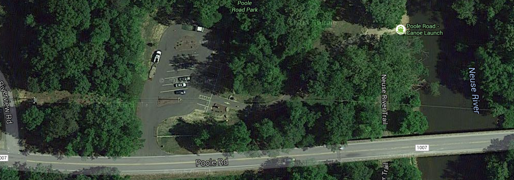
Parking/takeout Notes:
There is a paved parking lot, as well as several places to park in grass. This is a very popular place for bikers and walkers, so the parking lot does fill up.
There is a bit of a hike to the put-in. The put-in includes several wooden steps and a shoot that you can use(depending on the height of the water.) This one does get pretty muddy after a rain or when the river is flowing fast.
Auburn Knightdale Road
Caution: This launch has become more tricky and even dangerous in high water, like after a rain, due to nearby construction.
Parking Notes:
For parking, there is a paved parking lot for accessing the Neuse River Trail with plenty of parking usually available.
Put-In / Take Out Notes:
There are two ways to access this area:
Parking Lot Side Access:
If you park in the parking lot and carry your boat down the trail to the river approximately 600 – 700 feet, there are at least two areas that can be launched form.
From the parking lot, carry your boat down the trail and when it forks, turn right to walk over the wooden bridge. Immediately after the wooden bridge, turn left towards the river and there is a small path that you can follow to the rocks. Fisherman are often here.
If you walk a bit further, there is a different set of rocks a bit further down on the left.
Please note that in high water, this can be tricky, as the rocks are slippery and the water depth drops off quickly. In lower water the area a bit further down may be easier and in either case, watch out for mud as when the water recedes, the rocks can become slippery with mud.
Road Side Access:
When coming from Grasshopper road, there is a small access road on the left immediately before the bridge. It is possible to launch from here, but public access has been limited and especially during the summer, it has become very over-grown. From here, you can hike your boat down under the bridge and then move your car to the parking lot.
This spot is much easier to launch from though during low water, as a small sand island forms here.
If you pass over the bridge coming from Grasshopper road, there is also a small gravel spot on the right immediately after the bridge. It is possible to park here, hike your boat down under the bridge and launch off the rocks by the bridge, and then move your car to the parking lot.
My preference during the summer is the first option, carrying down the trail and launching from rocks, but especially in high/fast water, this can be a tricky launch, as the water depth drops off very quickly here.
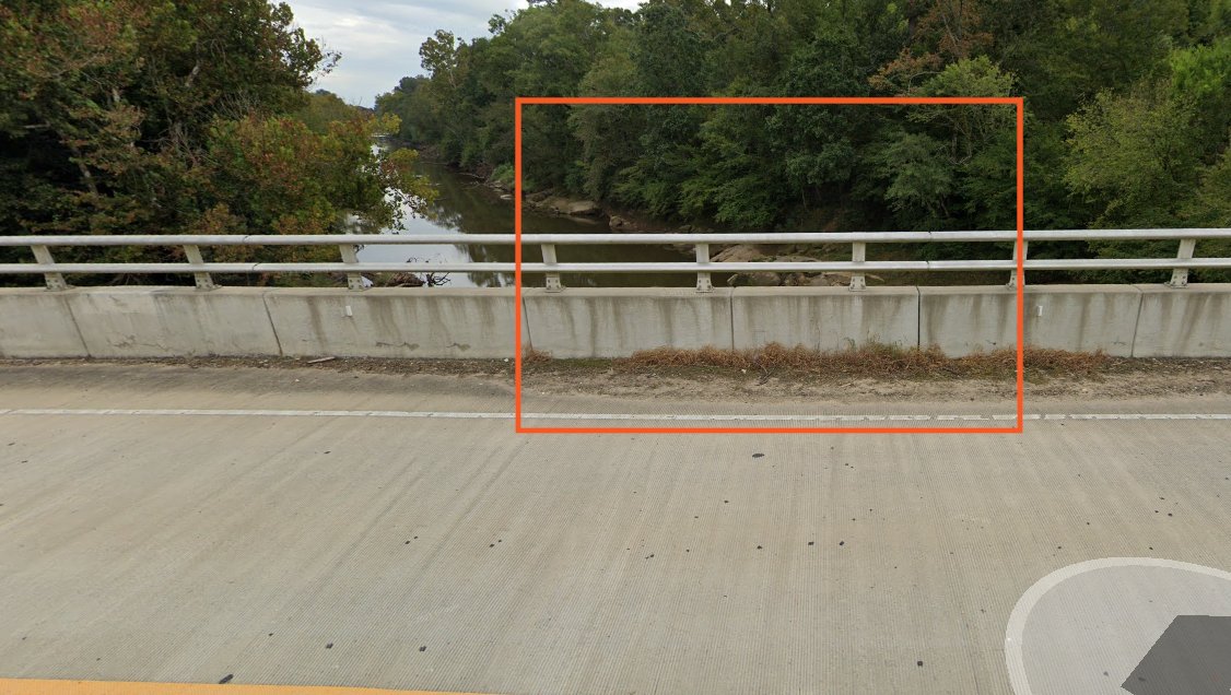
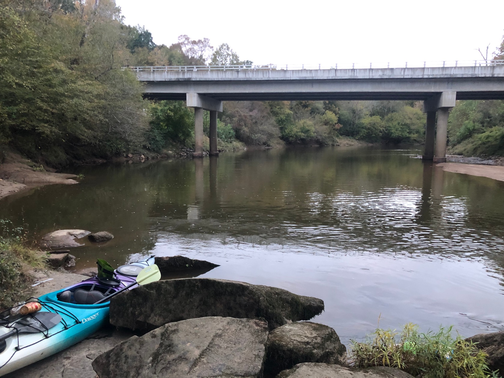
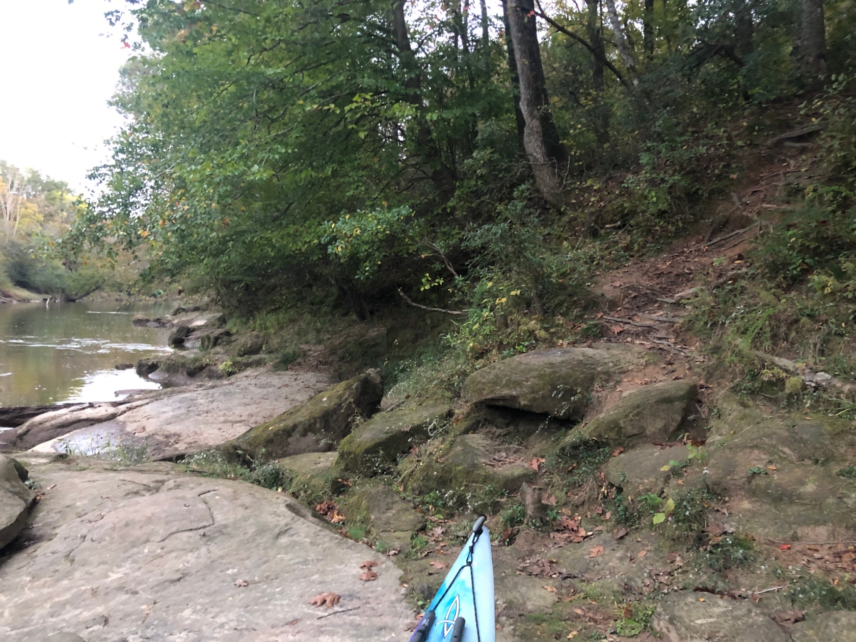
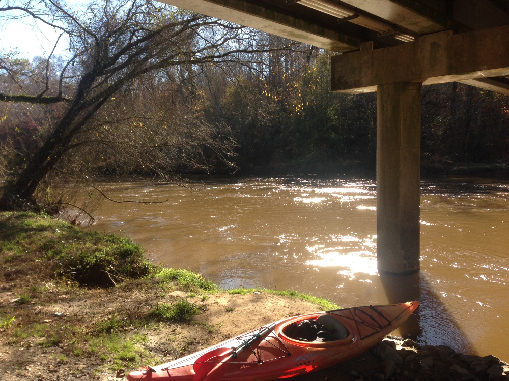
Covered Bridge Road
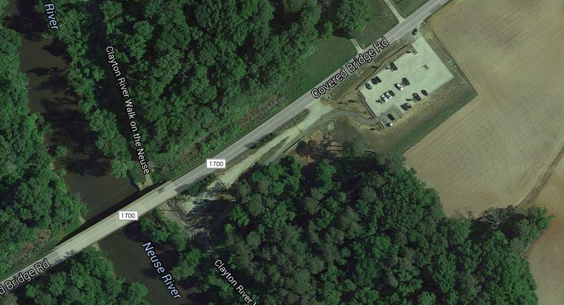
Parking/takeout Notes:
For parking, there is a gravel parking lot with plenty of spaces. I’ve not seen this fill up. Just before the parking area, there is a small gravel spot that you can park your car at temporarily to load up and save a couple hundred feet of walking.
To launch or get out, I’ve found it easiest to come in on the inside of the Bridge Pilings. It can get a bit muddy, but there are some rocks you can use to get up. Your kayak will need to be dragged up the hill.
Covered Bridge Rd, Auburn Knightdale Rd, and Mial Plantation Rd are probably the trickiest to launch from.
Mial Plantation Road


Parking/takeout Notes:
This is part of the Neuse River Trail and there is a paved parking lot and trail. Head towards the bridge and take the worn path off of the paved trail to get to river. It is a little steep and a bit of a scramble to get to the river.
Anytime I’ve passed the bridge, there have always been a lot of trees and branches caught on the pilings and a water gauge operated by NC State. So, take care of strainers, especially if the water is moving above average.
Highway 42, Clayton
Update 2023: Note that construction here has limited or changed access to this launch.
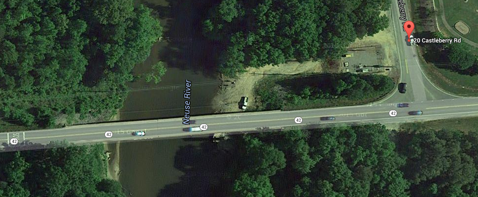
Parking/takeout Notes:
For parking, there is a gravel/dirt space at the top that can accommodate several cars. It is possible to drive down to the river, however there are some very deep ruts, so walk down there first to make sure your vehicle can make it!
There is a large flat area to launch from, which works well even when the river is very high. It can get a bit muddy though.
Market Street, Smithfield
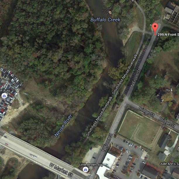
Parking/takeout Notes:
This is part of the Smithfield Neuse Riverwalk, so there is plenty of parking. There is also a semi-paved boat ramp, which you can use to launch from. You can drive your vehicle down to the boat ramp for loading.
The boat ramp can get pretty muddy, but the city does periodically clean it.
Other Takeouts
There are a few other places you can probably put in/take out on this stretch of the Neuse, however the above are the ones I use. Some(most?) of the below do not have great access or parking.
Some other possibilities are:
- Sam’s Branch Greenway, Clayton
- Fire Dept Road, Clayton – No Good Parking
- Highway 70 Clayton(Near Johnston Correctional Institution/Prison) No good parking, but can pickup by bridge
- M. Durwood Stephenson Hwy Smithfield No good parking and a hike to the road.
This has been very helpful. 1st trip was covered bridge to 42 and the 2nd was Auburn Knightdale to covered bridge. Looking to go 42 to Smithfield and would like to know if there are any rapids along this rout. The other 2 were pretty calm
Thanks, glad you found it useful!
No, there isn’t much in the way of rapids once you get past Poole Road.
At low water levels, there are a few spots where there are sometimes some small rapids, like just past Auburn Knightdale Road, ~ 1/4 mile down-river from the Poole Road Bridge, and sometimes right before you get to Highway 42.
However, Gunnison Rapid, by Poole Road, and now the old Milburnie Dam site, are the only place that consistently have rapids on this stretch of the Neuse.
Very helpful info! I’m curious, about how long would the Auburn Knightdale to Covered Bridge route take? We’ll have kids with us. Thanks!
Just an FYI, there is a really easy launch spot from Mial Plantation on the Neuse Riverwalk under the bridge there. Short and flat walk (~100-150 yards) from the parking lot, just follow the path through the grass under the bridge. There’s a little step down of about 2-3 feet before the water, but it is no problem getting a kayak down there and would be easy for a kid to traverse. Mial Plantation is about the half way point between Auburn Knightdale and Covered Bridge (~4 miles from each), in case you wanted to cut that run down a bit.
Thanks Stephen, I’ll add that to my list, as right now it is just in the ‘Other Takeouts’ section, as I never put in there.
We did the Mial Plantation to Covered Bridge stretch. It took about 1 1/2 hours and we didn’t take the kids because they said they’d had enough adventure after a week at camp. We will next time because we really enjoyed it! Thanks for your advice!
Awesome, glad you guys had a good time!
I added the Mial Plantation Neuse run to the list.
It depends a bit on how the river is running and how much paddling you do.
A conservative estimate when the river is running at its normal non-release rate of about ~300CFS, maybe 4-5 hours. That is 2 miles per hour. If you do semi-steady paddling, you could probably cut that down.
It might be better to start with one of the shorter runs, like Milburnie -> Anderson or if you don’t mind a couple small rapids, going down to Poole Rd.
The Auburn Knightdale -> Covered Bridge run is somewhat long and more rustic than the up-stream ones.
We did the run from cover bridge rd to Smithfield. How long does It take to go from Smithfield to Goldsboro
I did it with a friend several years ago and we broke it up into two days.
I can’t remember the exact mileage. If you pushed yourself and the water was moving a bit, it might be possible to do it in one day, but I think it would end up being a very long day.
The area right past Smithfield is very windy and narrow, so use caution there, as it wouldn’t take much for a tree to block it. There is also one dam and other obstacles to watch out for when you get close to Busco ATV Park.
How long did it take you to do Covered Bridge to Smithfield?
I’ve gone from Poole road to Richardson Bridge road in Kinston. Just the Smithfield to Kinston run is 40 miles-ish. It has 5 miles of nothing on one side, and 7 miles on the other side of the river. DO NOT get hurt. I’ve sent text and pictures while making that run and they Never were received! It is not if you will hit a log, it is how many will you hit! Hurricane damage. There are actually rapids made from fallen trees! I’ve run my scanoe and motor through there with an overnight camp. When I have paddled from Smithfield to Kinston (Very aggressively) it took 4 days and 3 nights. If you pass the I-95 bridge, you have 30+ miles until you will find help. Just sayin’! Personally, I’ve made that run more times than I can remember. If you want to see deer with nontypical antlers, or “Rocking chairs” on their head, you’ll be in for a treat. But, let someone know where you will be paddling. I have been in the river more than once because of those logs. If you do it, you will be hooked on that section. Isolation like no other run you will do. No houses, no fishermen no joke! Have fun, and I’m going tomorrow.
The Richardson Bridge Rd Bridge in NOT near Kinston. It is the next bridge after you go downstream from the bridges on I-95…. May be 20-ish miles on a very winding slow river and there is a NCWRC Ramp on the left just before the bridge.
I know this was an old post, but I didn’t want someone to make a mistake on their planning…..
Thank you for this excellent resource. I use it frequently. Do you have advice for runs lower than Smithfield?
Smithfield to Richardson bridge road! 30+ miles of isolation. Let’s go! Deer with LARGE non-typical antlers that just stare at you. You’ll feel like a wild animal after 4 days and 3 nights out there. I Love It!
My friend and I tried to do a run from covered bridge to Four oaks last year and didn’t make it. The river was way to low and to much floating. What would be a good launch point to be able to get to the four oaks campsite off the river to spend the night?
We did from Anderson Point to Mial plantation in 3 1/2 hrs recently but the river was at a good level and moving.
Neuse goes no where near Four Oaks. Seriously. Middle creek maybe, but not the neuse.